Politics
Morning Pulse: Arnab reaches Andhra as it begins landfall; coastal rain and disruption continue
Morning reports move from preparations to the storm’s arrival; later bulletins must establish when danger eases.
Pan India Pulse deskBased on reports from NDTV, The Indian Express, Reuters / MarketScreener, The New Indian ExpressUpdated 28 October 2026, 11:05 am ISTతెలుగులో చదవండి
Cyclone Arnab began making landfall along the Andhra Pradesh and Yanam coasts early on Wednesday, October 28, according to IMD updates carried by NDTV. This moves the story beyond Tuesday’s preparations. NDTV’s morning account says the process was prolonged and reports that the system was practically stationary in the bulletin issued at 6:30 am. The start of landfall should not be mistaken for the end of hazardous weather.
The morning coverage describes strong winds and high tides at Visakhapatnam’s RK Beach and a tree brought down near the Andhra University College of Engineering for Women. These are identified locations and reported impacts, rather than a complete statewide damage assessment. The account of the storm beginning to cross does not establish that every district has passed its period of greatest danger.
Preparations had already involved movement from vulnerable areas. The Indian Express’s October 26 report records Chief Minister N Chandrababu Naidu’s evacuation directions and deployment of National Disaster Response Force and State Disaster Response Force teams. That dated account supplies background to Wednesday’s response. Its earlier predicted crossing time should not be substituted for the newer IMD updates describing the landfall process.
Transport is another immediate concern. NDTV records a Civil Aviation Ministry review of airport and airline readiness and reports service suspensions at three Andhra airports in its overnight coverage. Travellers need the status of their particular flight from the airline and airport. The review does not establish a universal reopening time or mean that an unaffected airport elsewhere has stopped operating.
Naidu’s reported instructions include restoring electricity after disruptions and removing fallen trees and hoardings that obstruct traffic. Those are response priorities, not confirmation that restoration has finished. The next useful assessment will connect district reports to completed repairs, relief arrangements and access conditions. The inspected accounts contain changing wind estimates, so this Pulse does not combine different bulletins into one current measurement. Nor does it claim a final casualty count, complete damage total or statewide reopening from incomplete morning reports.
Reuters independently reports the prolonged coastal landfall and disruption to power supplies and transport on October 28. Its updated account also describes the system as nearly stationary, reinforcing the need to follow later bulletins instead of the original crossing timetable.
NDTV’s 7:24 am update gives rainfall observed at IMD stations between Tuesday 8:30 am and Wednesday 5:30 am:216.9 mm at Visakhapatnam,147.5 mm at Kalingapatnam,123.3 mm at Tuni and 118.4 mm at Kakinada. These are station totals over a specified period, not statewide averages. The differences show why the district picture matters during the same storm. Reuters’ updated morning report separately confirms suspended operations at three Andhra airports. Together the evidence describes both weather and service disruption, while leaving individual reopening decisions to the responsible authorities. An observed total should not be presented as rain forecast for the next 24 hours.
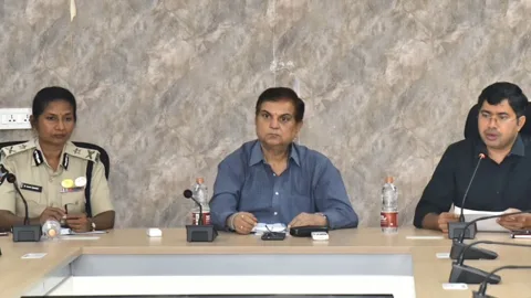
In his Wednesday review, Naidu said no casualties had been reported so far, according to The New Indian Express. Reuters’ morning account independently reports no loss of life reported at that stage. These are time-limited statements, not a final casualty assessment. The chief minister directed officials to clear blocked roads within two hours, restore electricity once strong winds subsided and provide food, drinking water and medical support at shelters. A direction to finish work is not confirmation that it is complete.
Political Alignment Lens
Article framing only. This does not establish publisher affiliation, reader beliefs or voting intent.
Pulse view
Analysis by the Pulse deskThe change since the evening is the storm’s arrival. Andhra’s response now has to follow ground conditions as well as track forecasts: evacuation, electricity repair and transport decisions serve different needs and may proceed on different timetables.
If later IMD bulletins show weakening, local flooding and damaged infrastructure would still need assessment. District restoration notices are more useful than an unsupported statewide declaration of normality. Which update would most help your locality today: shelter availability, electricity restoration or travel information?
What could happen next
Conditional scenarios based on current reporting, not confirmed plans or election forecasts.
If the storm weakens inland, safe-return decisions will still depend on local flooding and damage.
Morning reporting describes a prolonged landfall after earlier evacuations.
Watch for: Later IMD bulletins and explicit district safe-return or restoration notices. Reporting behind this scenario
What to watch
- Later IMD movement and intensity bulletins.
- District safe-return and relief-centre notices.
- Airline and airport service updates.
Your take
Do you agree with the Pulse view?
Sources
- Live IMD updates and coastal impacts NDTV
- Dated evacuation and response-team preparations The Indian Express
- Updated account of stalled coastal landfall Reuters / MarketScreener
- Chief minister’s October28 response review The New Indian Express
This piece is analysis written only from the published reports listed above. Pan India Pulse does no original reporting. How this site works